
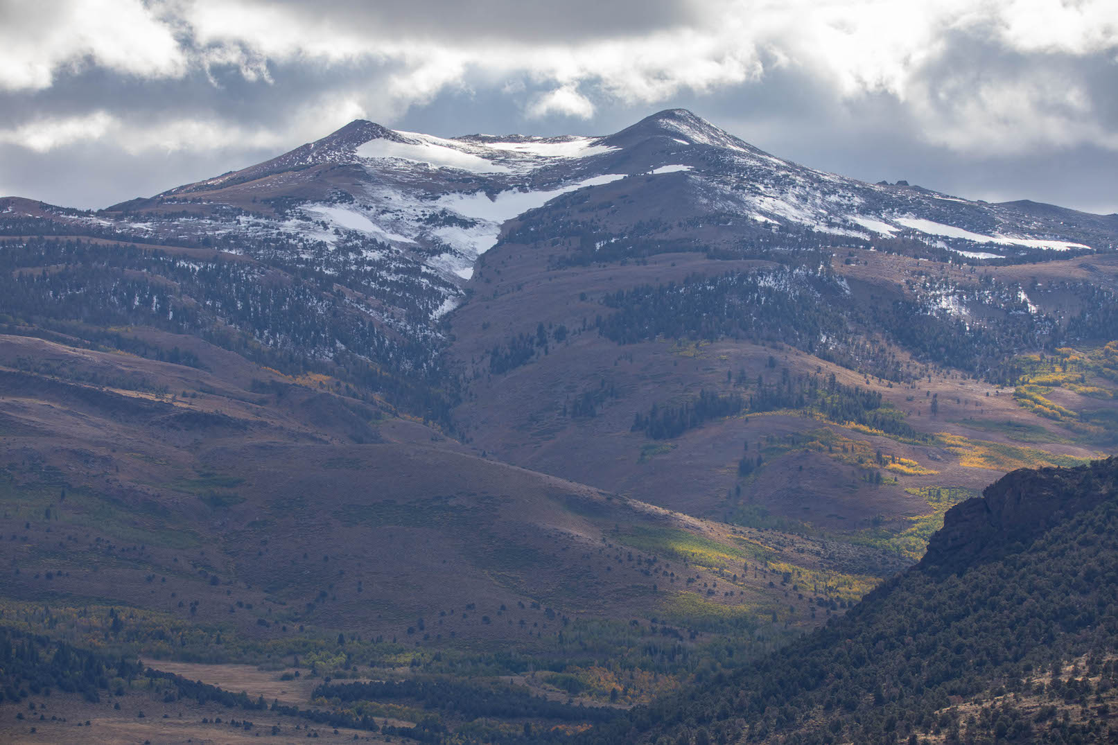
A wild weather pattern earlier this week brought fall colors in the state to attention. After the most delayed start that color spotters in Mono County have seen in their 12 years of reporting on fall colors, the color change is finally in full swing and several areas are at the GO NOW rating.
Additionally, color spotters in Plumas County have been reporting a bit of an early start with plenty of brilliant colors to come.
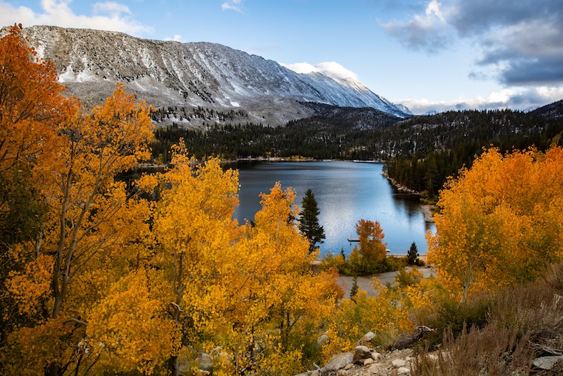
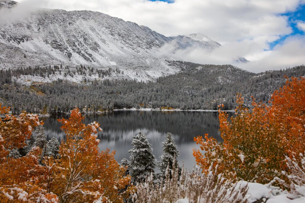
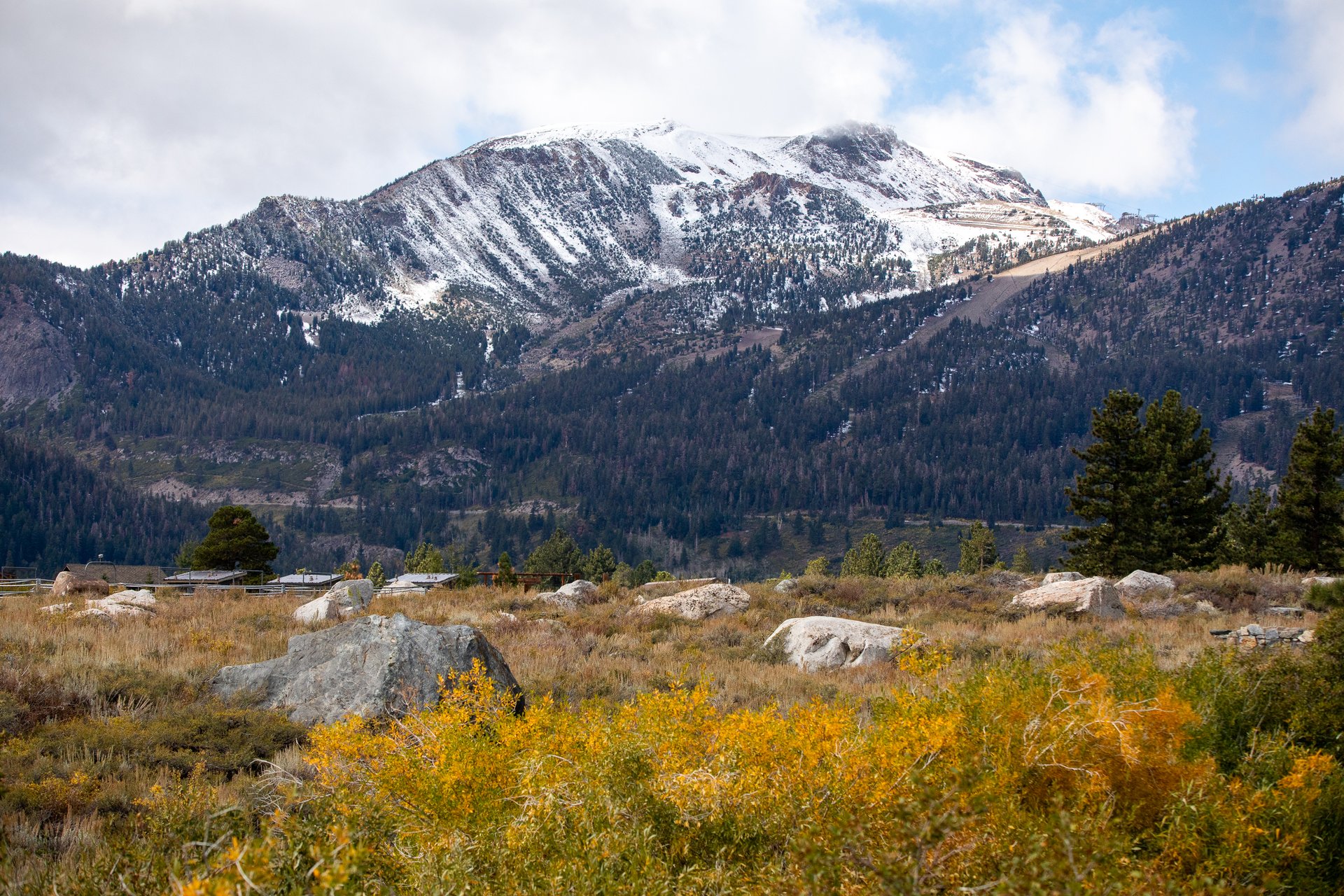
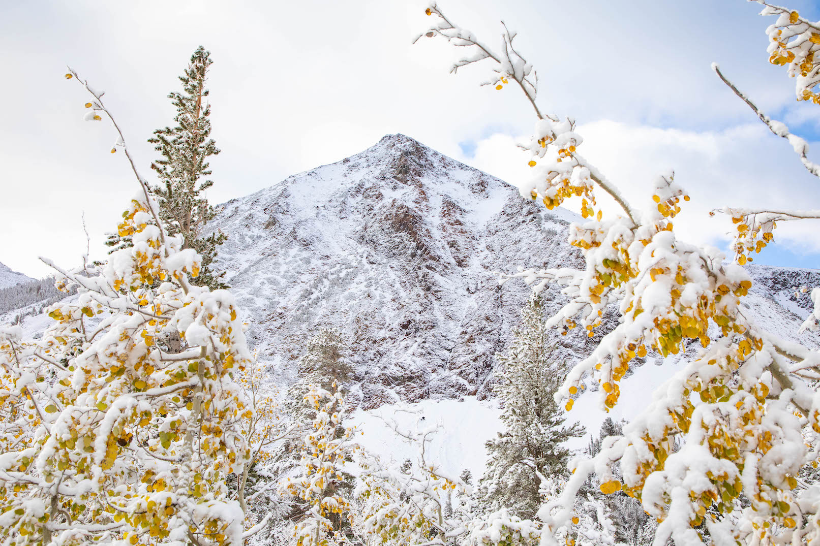
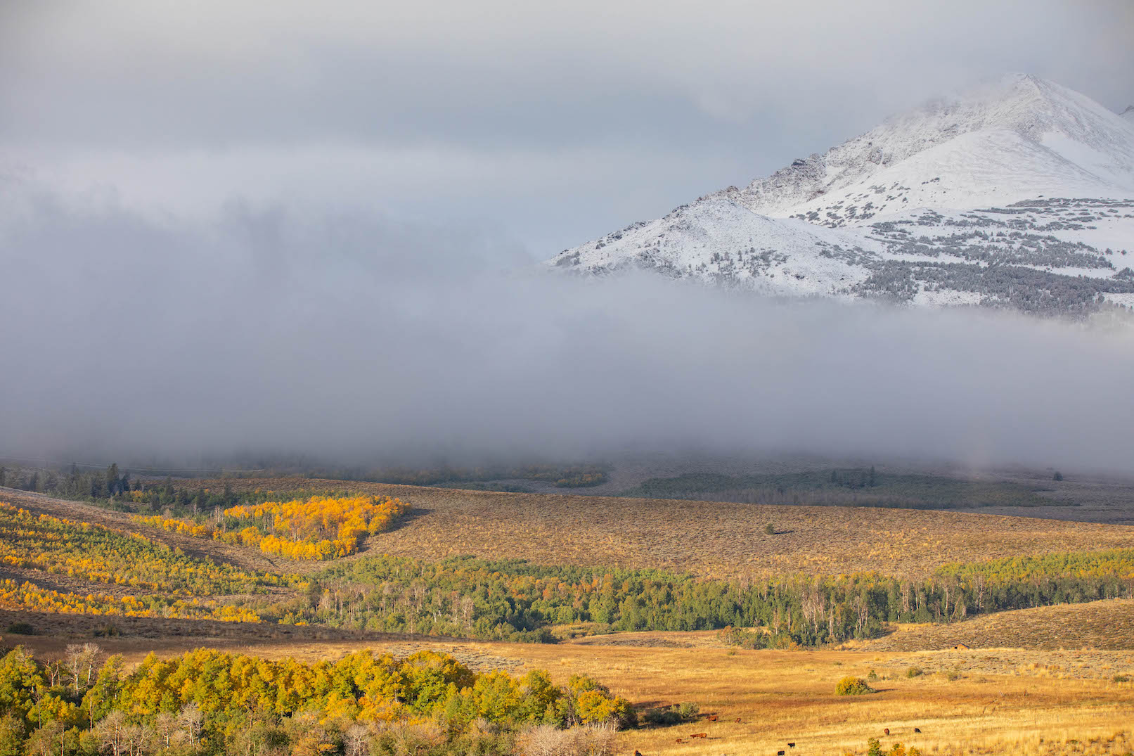
In Mono County trees were still green last Friday, Sept. 29 at locations that in past years would be at full peak. The change came fast though – almost overnight, according to color spotter Jeff Simpson. A wintery-weather system moved in on Friday night and lasted through the weekend, bringing cooler temperatures, rain, and even 2-6” of light snow to the higher elevations. This was a welcome surprise for photographers as it provided ideal conditions for landscape pictures with fall colors and freshly snow-capped peaks early Monday morning. Thankfully, the leaves held on and warmer temperatures on Monday quickly melted the snow.
As of October 4, Mono County was back on schedule! The forecast for the next 8-10 days shows above-average temperatures with no precipitation in sight. It should be perfect conditions for fall color viewing for the foreseeable future.
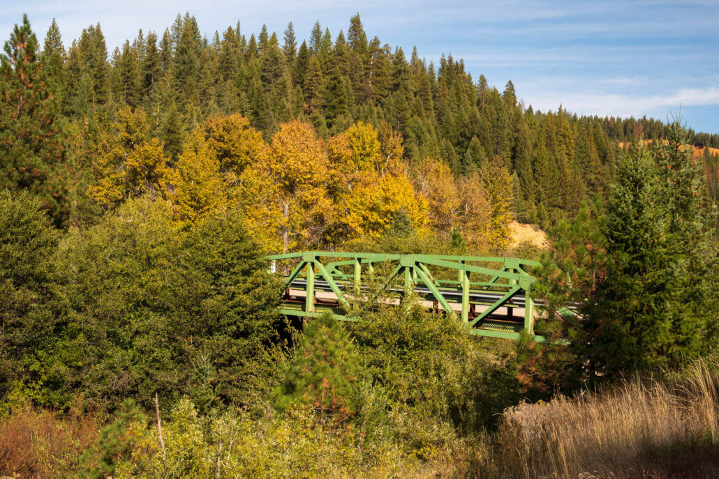
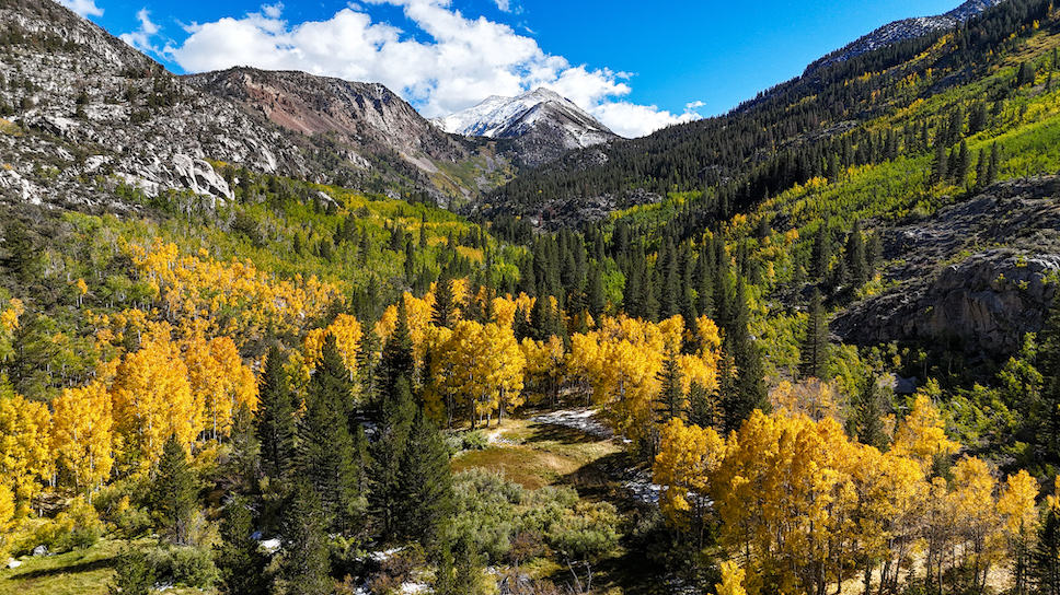
Lobdell Lake Road, Virginia Lakes, Rock Creek Lake, and Sagehen Summit are all peaking and are at the top of our list for visiting this weekend with “GO NOW” conditions. All three locations are closer to 75% than 100%, with lots of green mixed in with the yellows and orange, which means they should be perfect for the next seven days or so.
Lobdell Lake Road requires AWD or 4WD, so if you’re comfortable with rougher dirt roads we are sure you’ll love one of our favorite fall color spots in the Eastern Sierra.
Sagehen Summit still had green as of Oct. 4, but the colors should keep progressing there as we approach the weekend. Rock Creek Lake is at full peak around the lake but still green as you head down in elevation along the road. The best color in Virginia Lakes is located around the trailhead parking lot and along Dunderberg Meadows Road (AWD or 4WD recommended here, too).
We’re well on our way with still plenty of color change to come! Plan your trip within the next three weeks to catch the fall brilliance in-person.
WALKER / COLEVILLE / TOPAZ
Monitor Pass (8,314′) 10-50% – Patchy with the best color near the pass.
West Walker River, Walker, Coleville and Topaz (5,200′) 0-10% Some leaves changing in Walker Canyon with this area usually peaking the last week of October.
Sonora Pass (9,623′) 10-50% We didn’t make it up to the summit this week but could see lots of green around the Leavitt Falls elevation.
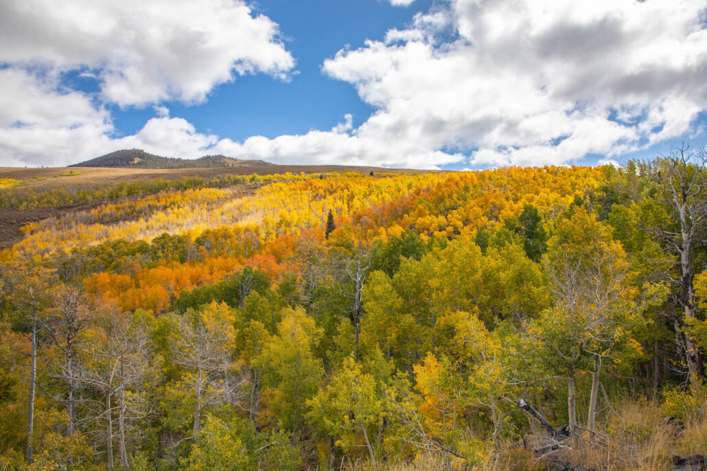
Lobdell Lake Road (9,274′) 75-100% GO NOW! Lots of great color all the way up the road to the lake. One section of trees had red, orange, yellow and green leaves within a 100 feet of each other. Lots of contrast and varying degrees of color. This spot should be great for the next 10 days. (The road has been repaired but AWD/4WD is highly recommended.)
BRIDGEPORT / VIRGINIA LAKES
Twin Lakes (7,000′) 0-10% just a few leaves around each lake at this point.
Bodie Hills (9,419′) 10-50% There are great pockets of color and should be approaching peak by next week. (Some sections of road have been washed out from the spring runoff. AWD/4WD is highly recommended.)
Virginia Lakes (9,819’) 75-100% GO NOW! The best colors are at the highest elevations. Trust us when we say to take the dirt road detour on Dunderberg Meadows Road as there are some beautiful groves of crimson red happening right now.
Conway Summit (8,143) 10-50% a couple of good groves of yellow up the hill but mostly green near US 395 at the summit.
Summers Meadow (7,200′) 10-50% Full peaking trees at the highest elevations but mostly green along the road.
LEE VINING
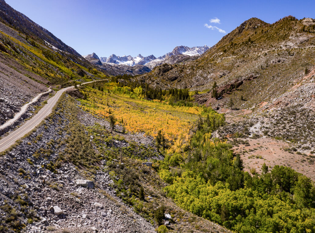
Tioga Pass (9,943′) 50-75% Near Peak No new update. While there are few aspen trees in this area, you will still find fall color near peak in the bushes and grasses with scenic views.
Lee Vining Canyon (6,781′) 10-50% Some really great groves near the ranger station and in Lower Lee Vining Campground. This location should be approaching near peak by next update.
Lundy Lake & Canyon (7,858′) 10-50% some great sections with yellow trees but still mostly green.
BENTON & 120 EAST
Sagehen Summit (8,139’) 75-100% GO NOW – Still maturing in some sections with green on the lower elevations. Maybe 5 days to perfect color. (There are no bathrooms located here. Please drive slowly long the paved and dirt sections to this locations as there are a lot of wild horses in the area)
JUNE LAKE LOOP
June Lake Loop/Hwy 158 (7,654′) 10-50% A couple groves of color in sections north of Silver Lake but still getting going.
MAMMOTH LAKES
Mammoth Lakes Basin (8,996′) 10-50% Patchy – Colors within the Mammoth Lakes Basin are spreading throughout specially with the bushes. This is a great option for call colors right within Mammoth Lakes!
CROWLEY LAKE/McGEE CREEK/CONVICT LAKE
McGee Creek Canyon (8,600’) 10-50% No big changes from last week. Patchy Shades of yellows and lime are lining the river here, casting colors throughout the canyon. The best colors will be located on foot up the trail.
Around Crowley community (6,781′) 10-150% Some nice color starting to make it’s way down into the town.
Convict Lake (7850′) 10-50% Patchy – Not much change. Golden and lime hues are lining the lakeside, creating an enchanting atmosphere. This location is a perfect choice for those seeking a leisurely stroll among the trees, as a scenic path winds its way along the back of the lake, immersing you in a lush canopy of changing leaves.
ROCK CREEK CANYON
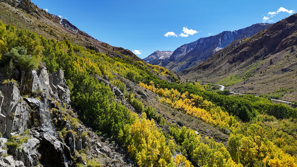
Rock Creek Road (9,600’) 75-100% GO NOW! – Rock Creek Lake is spectacular with most of the trees at “peak” around the lake. However, the at “peak” sections are very localized and you will still see greens along Rock Creek Road.
INYO COUNTY
In Inyo County, Bishop Creek Canyon has been a treat for photographers this past week with a mix of snow and color as well. Anyone who was out last weekend was able to capture multiple seasons in one shot. Certain portions of this area are also in GO NOW condition with beautiful weather on the horizon for the next few weeks.
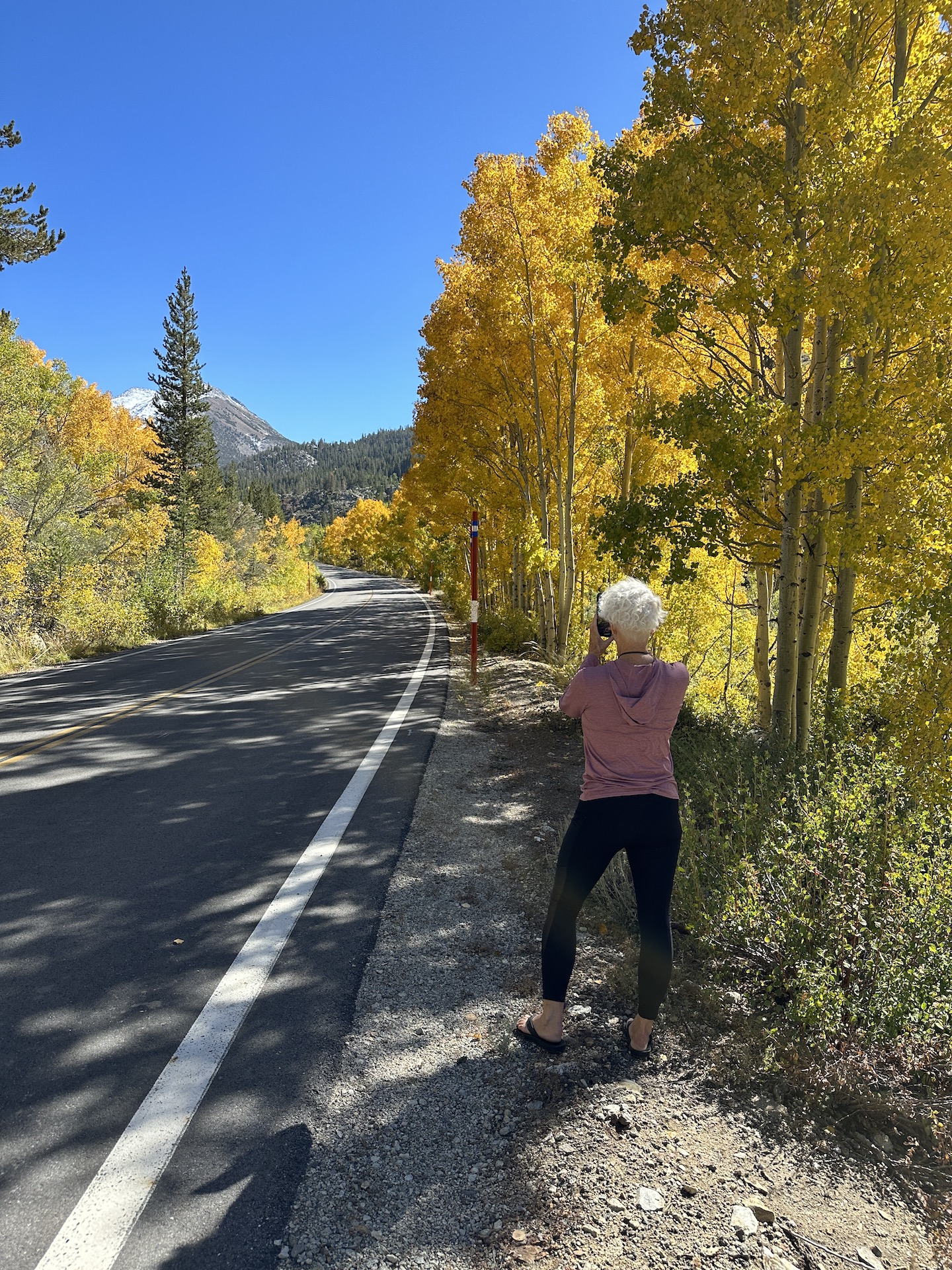
It is important to note this year that while roads are open in the Eastern Sierra for leaf peeping, many are narrow with limited parking. Please take extra care when you stop for photos this year as some of the shoulders of the roads have been impacted/washed out.
Southern Inyo County
Lots of yellows on the cottonwoods in the valleys and aspen in the high country. Little bits of orange here and there.
- Lone Pine (3,727′) – (10-25%)
- Alabama Hills (4,534′) – (10-25%)
- Whitney Portal (8,375′) – (10-25%)
- Mt Whitney Trail (8,360′ to 14,505”) – (10-25%)
- Independence (3,930′) -(10-25%)
- Onion Valley (9,600′) – (10-25%)
- Big Pine Creek (7,660′) – (10-25%)
- Big Pine (3,989′) – (10-25%)
Bishop Creek Canyon
According to color spotter Betsy Forsyth, “Bishop Creek Canyon is beautiful!! We had a really beautiful few days of snow in the high country last weekend which created some incredible contrast of fall colors with the snow. It was short-lived and the snow has pretty much all melted around the lakes in Bishop Creek Canyon. It seems like about half of the Canyon is yellow with an orange hue. There is still lots of green leaves as well.” There is still a lot of rabbitbrush blooming on the way up Highway 168 as well as some mosquitoes. Wildflowers are still visible up in the high country and some can even be found on the road to Lake Sabrina.
South Fork, Bishop Creek
- South Lake (9,768′) – Patchy (10-50%)
- Weir Pond (9,650′) – Patchy (10-50%) There are a couple of beautiful trees, but mostly green leaves around the pond. Yellow starting up the hills.
- Parcher’s Resort (9,260′) – Patchy (10-50%)
- Willow Campground (9,000′) – Patchy (10-50%)
- Surveyor’s Meadow (8,975′) – 50-75% – Near Peak (Go Now!) Some beautiful yellows here. Closer to 50%. This is one of the more spectacular spots right now.
- Table Mountain Camp (8,900′) – Patchy (10-50%) Some beautiful yellow trees here surrounded by green groves. Some orange leaves spotted here. And some just going form yellowish to falling off the Aspen. Not super vibrant, but colorful.
- Mountain Glen Camp (8,850′) – Patchy (10-50%) Some beautiful yellow trees here surrounded by green groves.
- Mist Falls and the Groves Above Bishop Creek Lodge (8,350′) – 50-75% – Near Peak (Go Now!) Always a stunning spot in the fall!
- Four Jeffries (8,000′) – Patchy (10-50%). This section of the road has a yellow-brown hue. Not super spectacular, but changing colors for sure.
Middle Fork, Bishop Creek
- Lake Sabrina (9,150′) -Patchy (10-50%). Closer to 50%. There are a few patches of orange, with plenty of yellows and still lots of green. This area will be getting really good VERY SOON.
- Sabrina Approach (9,100′) – Patchy (10-50%) Mixed yellows and greens along the road. Again, closer to 50%. We’re still hoping to get some oranges along this road, as it is so spectacular.
- Sabrina Campground (9,000′) – Patchy (10-50%) Still pretty green.
- Groves Above Cardinal Village (8,550′) – 50-70% GO NOW The upper part of the canyon above Cardinal Village is all yellow, and hopefully the lower part will get some nice bright colors.
- Aspendell (8,400′) – Starting (0-10%)
- Intake II (8,000′) – 50-70% GO NOW Lots of orange and yellow here.
- Big Trees Campground (7,800′) – Patchy (10-50%)
North Fork, Bishop Creek
- North Lake (9,225′) – Patchy (10-50%) Go Soon!! This seems like it should be really beautiful soon. Still mostly green along the road by the lake, with some yellows. Across the lake there are some yellows starting.
- North Lake Rd (9,000′) – Patchy (10-50%)
Bishop
- Bishop (4,150′) – Patchy (10-50%) Yellows in the upper parts of the cottonwoods.
- Buckley Ponds (4,150′) – Patchy (10-50%)
- Rawson Ponds (4,150′) – Patchy (10-50%)
- Owens Valley (4,000′) – Patchy (10-50%) It’s really beautiful throughout the Owens Valley. There is a fair amount of yellows in the upper parts of the cottonwoods.
Northern Inyo County
- Lower Rock Creek Rd (7,087′) – Patchy (10-50%)
- Round Valley (4,692′) – Patchy (10-50%) It’s really beautiful throughout the Owens Valley. There is a fair amount of yellows in the upper parts of the cottonwoods.
- Lower Pine Creek Canyon (7,000′) – Patchy (10-50%) The lower part of the canyon has some yellows, but still has a ways to go. This is a spectacular canyon when you catch the colors and the light right!
- Pine Creek Pack Station (7,.400′) – Patchy (10-50%) At the top of the canyon there are some yellows in the Aspen, but everything else is mostly green.
PLUMAS COUNTY
Quincy is about 25% of peak overall, with some trees showing much more than that, like the Theiler Tree, which is almost at peak.
There are some nice colors on the drive to Meadow Valley (Snake Lake Bridge) but the Aspens at Bucks Lake still haven’t turned.
Indian Valley and Genesee Valley are at about 10% of peak so still more brilliant colors to come.
Antelope Lake is beautiful right now. Photos to come!

PEAK, DRIVE AND HIKE OF THE WEEK
Predicted to have California’s best fall color overall, best fall color drive and best hike in the coming week.
- Peak of the Week – Lobdell Lake Road (Mono County)
- Drive of the Week – Lobdell Lake Road (9,274′) 75-100% GO NOW! Lots of great color all the way up the road to the lake. One section of trees had red, orange, yellow and green leaves within a 100 feet of each other. Lots of contrast and varying degrees of color. This spot should be great for the next 10 days. (The road has been repaired but AWD/4WD is highly recommended.)
- Hike of the Week – Rock Creek Lodge to Rock Creek Lake (Mono County) 2 miles round trip – 300 ft. elevation gain. This quiet hike leaves the lodge and meanders beside Rock Creek, through meadows and a lodge pole forest. There is excellent fishing along this stretch and also at the pond, about 3/4 mile from the lodge. Behind the inlet of the pond the trail climbs alongside the creek as it cascades for a couple hundred feet. The trail levels out again, following the tail water of Rock Creek Lake.


Just curious: is there any explanation for places that are significantly higher altitude (like Sabrina) only just starting while others nearby but much lower (like Intake 2) are much further along? Seems like this year the general rule of High-to-Low progression has more outliers than usual.
Hi Uncle Ebeneezer, this year is an odd anomaly, although it’s happened before. Our advice is to follow reports and plan to go where it is best 🙂
Hello. We are thinking of driving up to the Lobdell Lake drive but we only have front wheel drive car. We wonder if 4 wheel drive is necessary and is that because of the road is unpaved or there’s other reason? Thank you!
Hi Sophy, Lobdell Lake can be driven with front wheel drive, but cautiously in spots where the road is sunken in.