
It’s hard to believe another week has already flown by — and even harder to believe it’s officially October! Fall is truly in the air now and this week Tioga Pass in northern Mono County is at Peak. GO NOW! to this location.
Other hotspots include Lobdell Lake Road (see notes about the road conditions here), Virginia Lakes, Conway Summit/Dunderberg Meadows, and Lundy Lake and Canyon, all of which are Near Peak. Scroll all the way down from beautiful photos from all of these locations and more!
As we head into October, the forecast looks cooler overall, with the chance for rain (and snow above 10,000 feet) later this week. If temperatures dip enough, we may see some rapid changes in color — so if you haven’t made plans yet, now’s the time. Even areas that aren’t yet peaking are absolutely beautiful right now, and if Mother Nature cooperates, the next two weeks should bring a spectacular show for all who venture here.
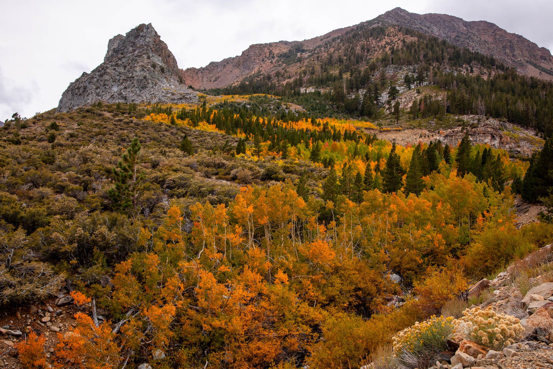
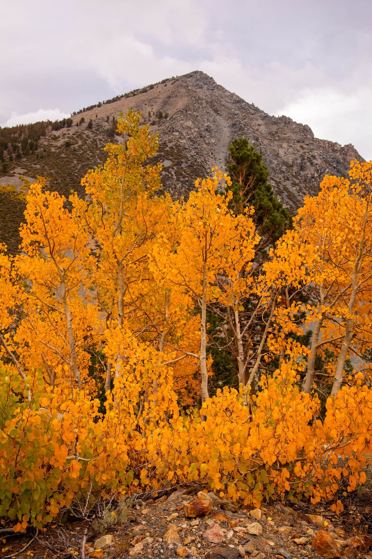
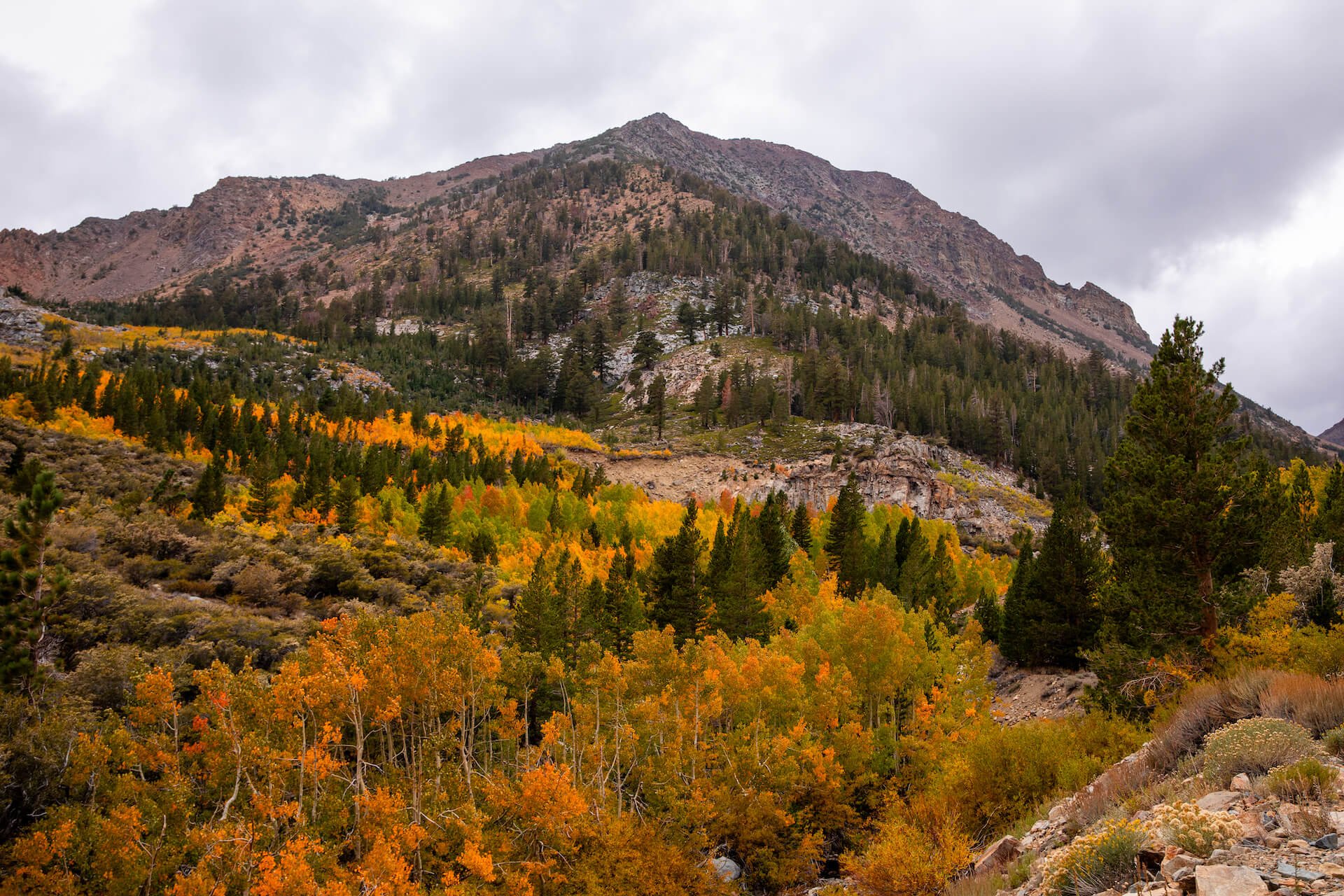
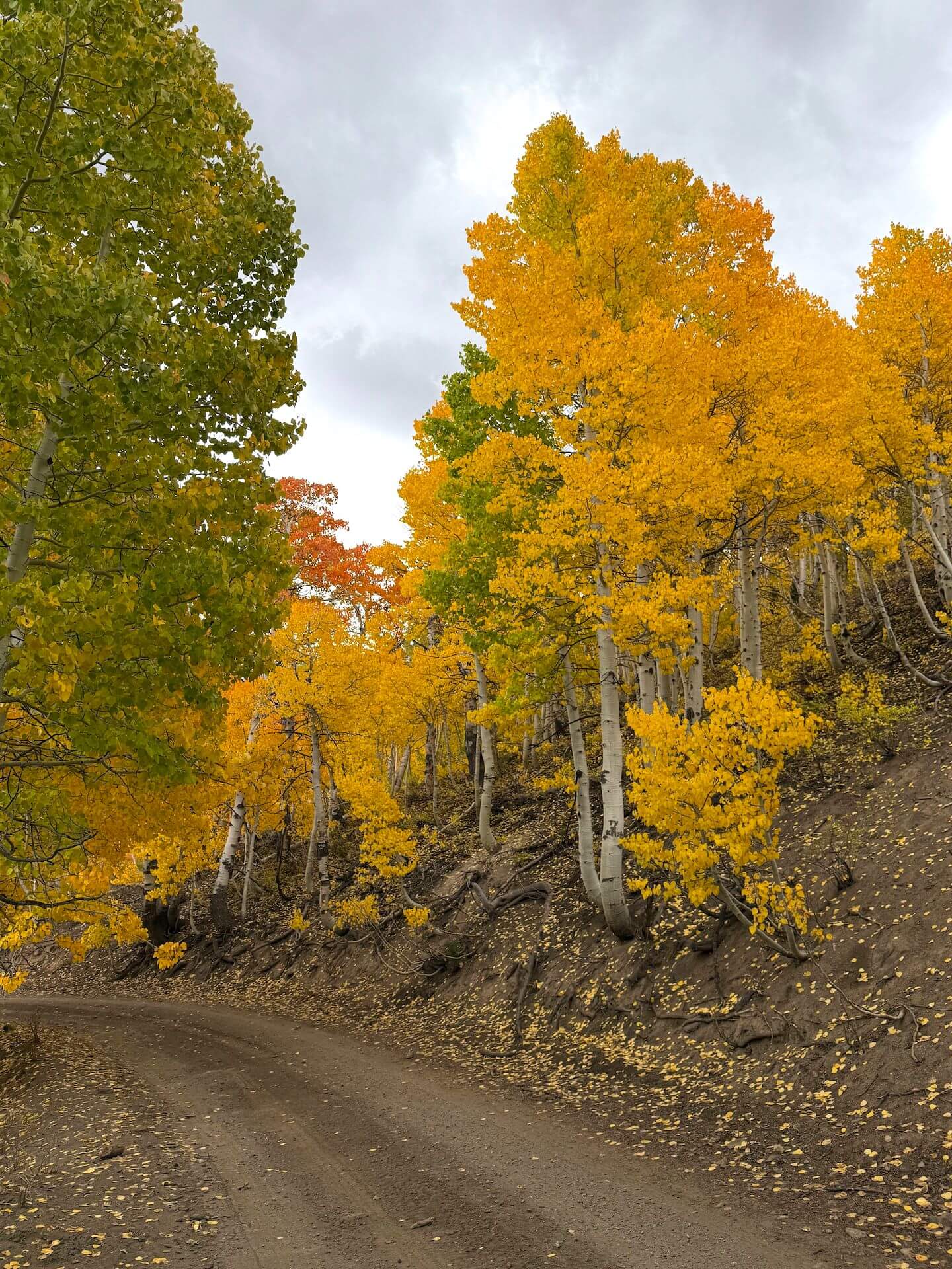
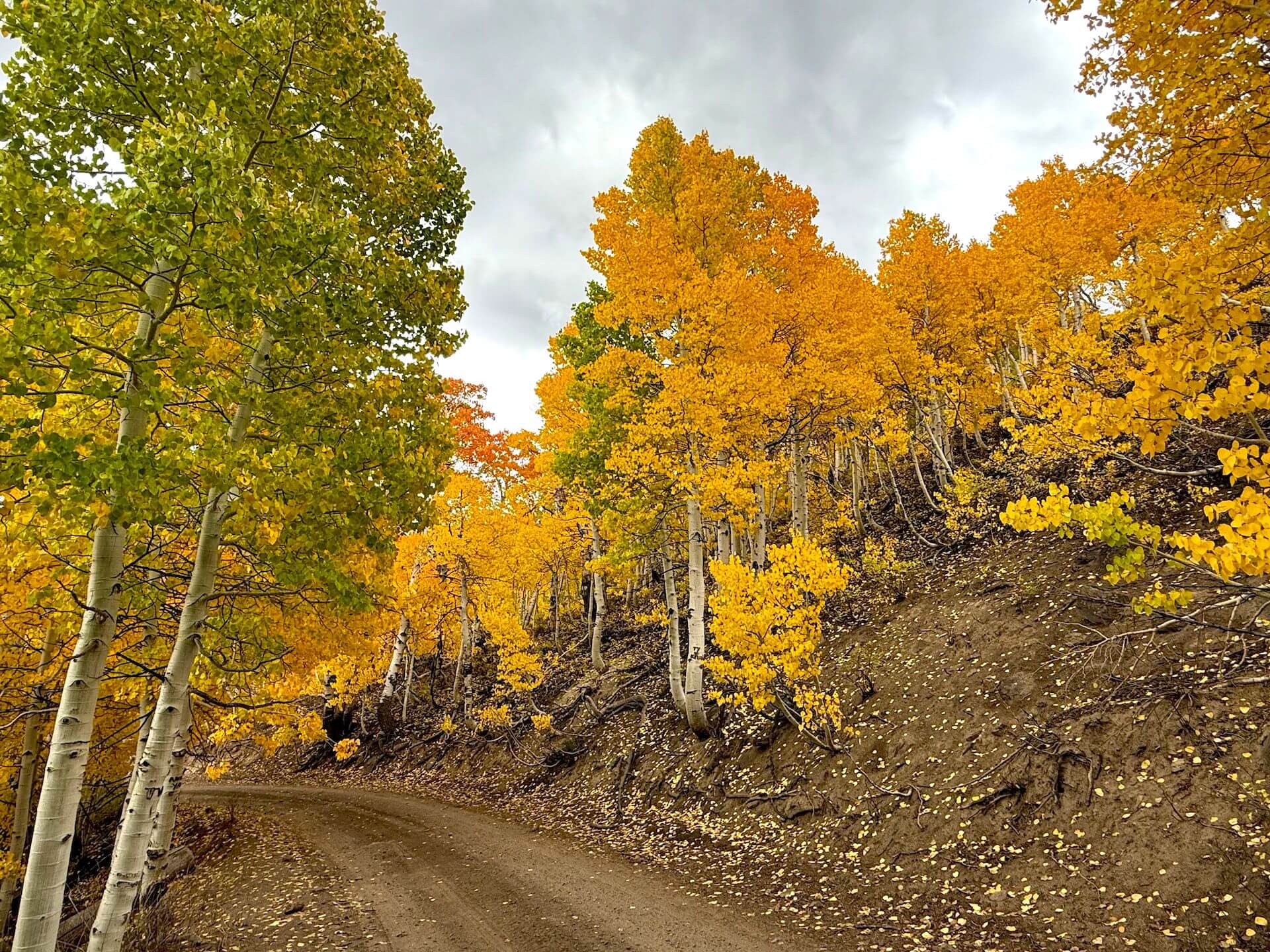
Tioga Pass (9,943′) — 75-100% Peaking (GO NOW!)


WALKER / COLEVILLE / TOPAZ
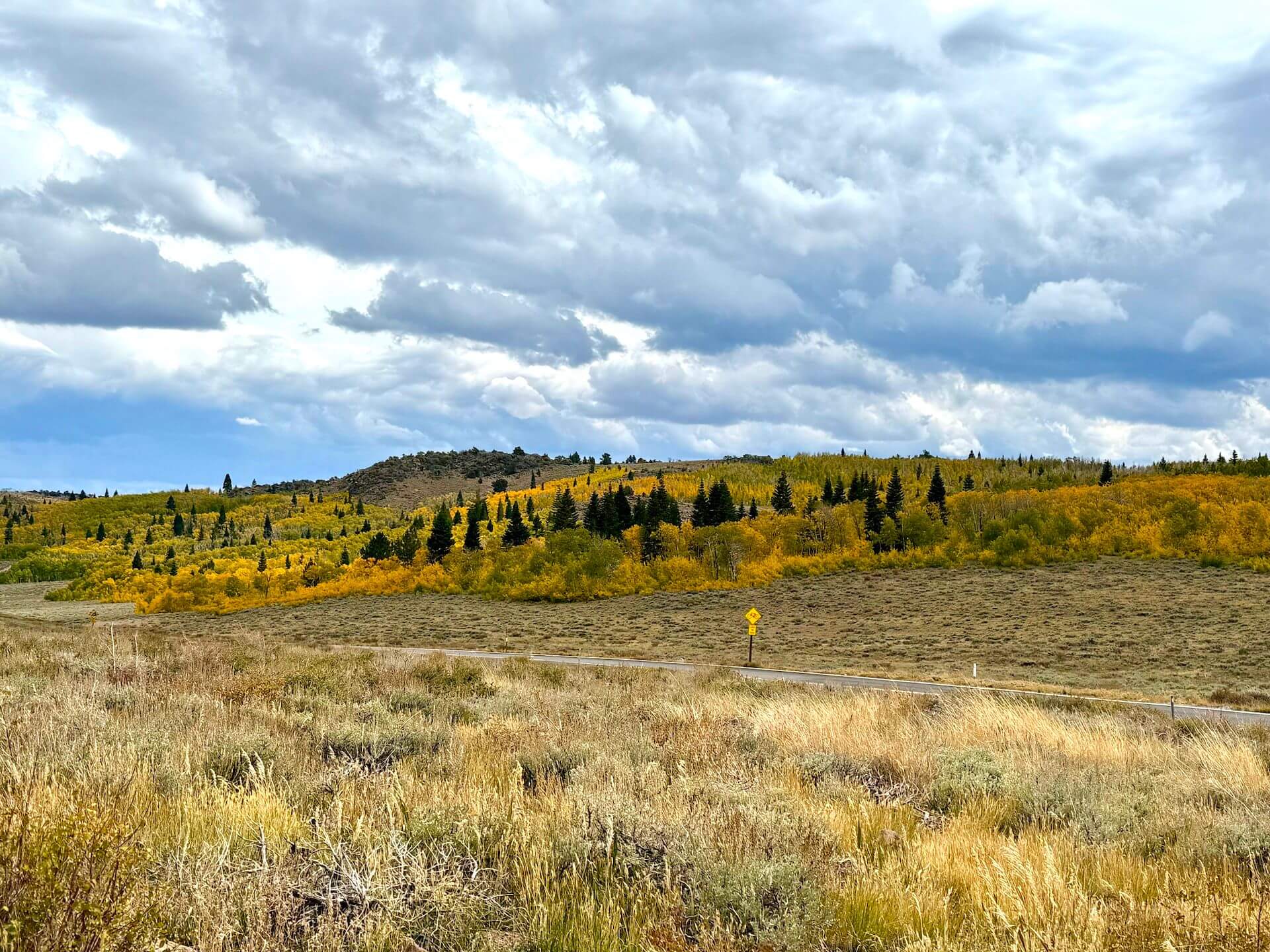
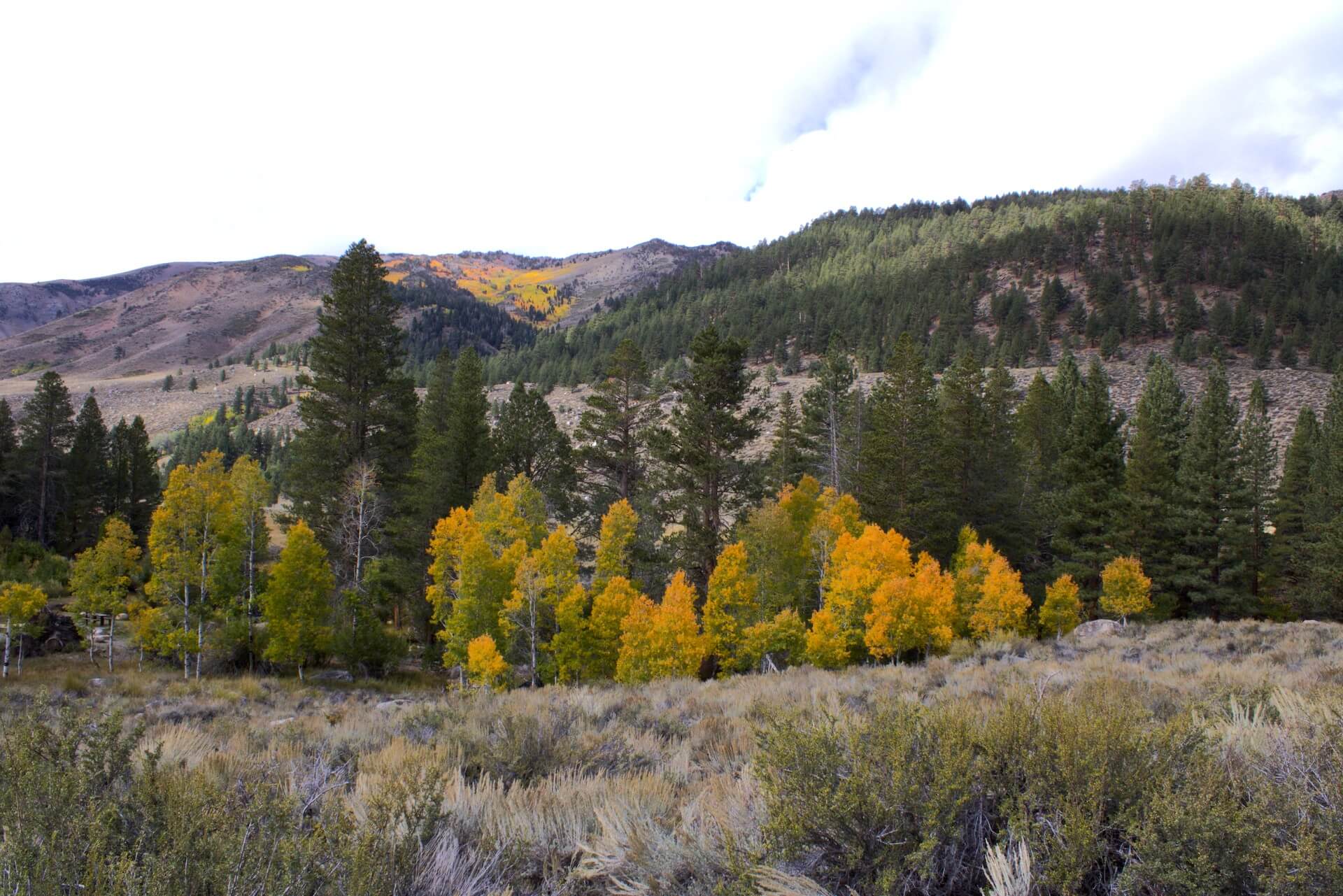
Monitor Pass (8,314′) — 10-50% Patchy. Monitor Pass remains in the patchy stage, with some impressive groupings of trees already showing vibrant orange, while the majority are transitioning to yellow. This scenic drive is well worth the trip, offering sweeping views of Mono County’s Antelope Valley.
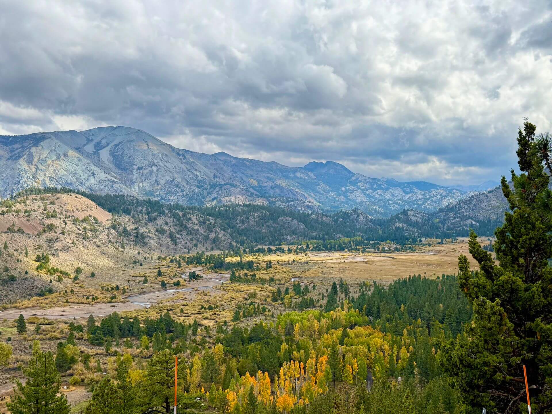
West Walker River, Walker, Coleville & Topaz (5,200′) — 10-50% Patchy. This area is just beginning to show fall color! Glimmers of yellow or starting to spread around the river and the cottonwoods near Topaz. This Northern Mono County region generally peaks later or last, but the cooler weather this week could speed things along, and we’ll update next week with any progress asap.
Sonora Pass (9,623′) — 10-50% Patchy. Sonora Pass remains mostly patchy, with a mix of yellow and green across the landscape. This scenic route rivals Tioga Pass in beauty and shouldn’t be overlooked, especially with pockets of fall color to enjoy along the drive.
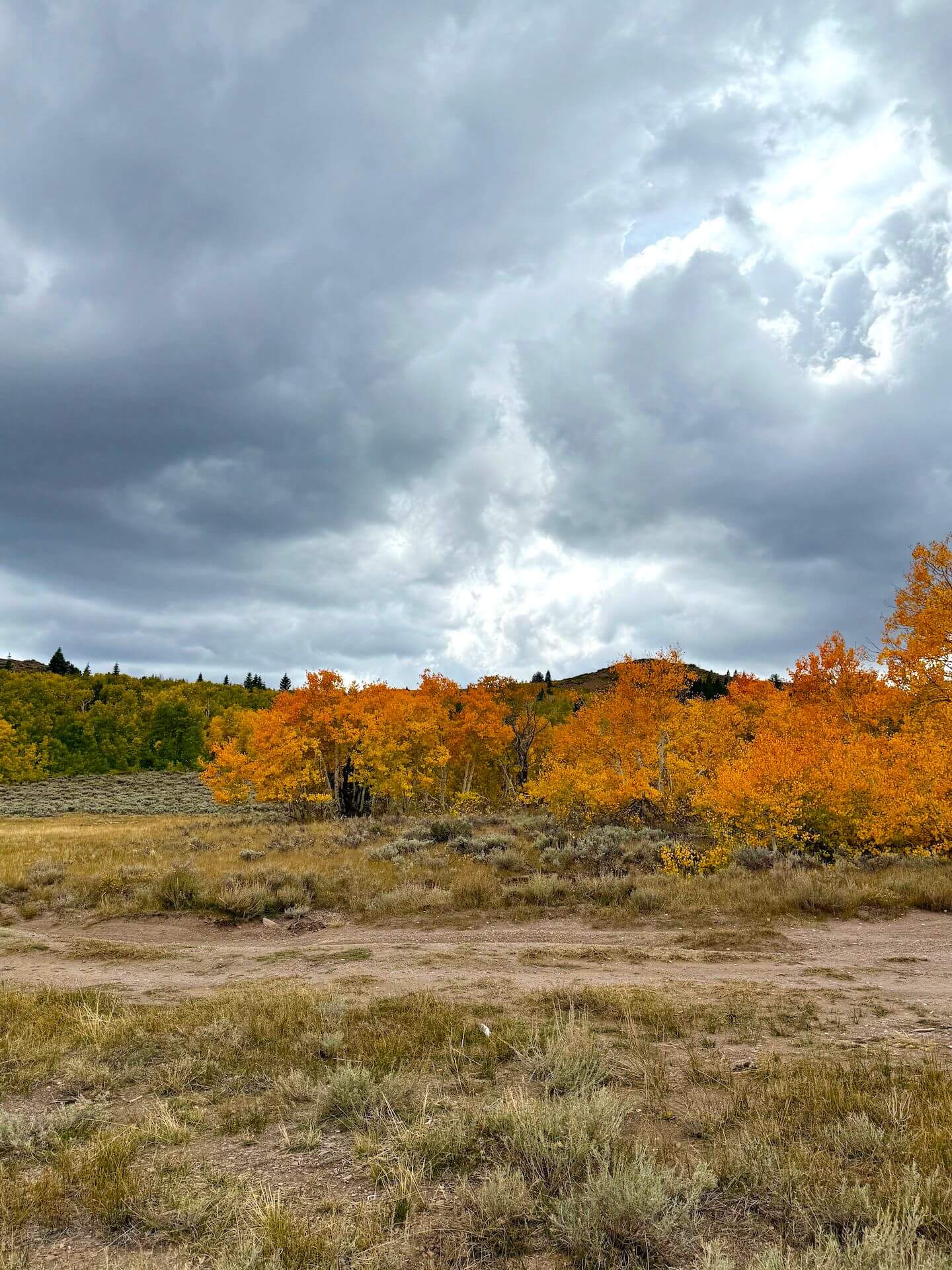
Lobdell Lake Road (9,274′) — 50-75% Near Peak (Go Now.) Lobdell Lake Road has just moved into the 50–75% range, with vibrant reds, oranges, and yellows. Green pockets remain, but change is progressing quickly, making this a great spot to visit this weekend or next.
Note: Lobdell Lake Road is in bad shape this year and we do not advise driving past the recommended turnaround spot (see map). Up to that point, you’ll enjoy big, beautiful views and a safe place to turn around. Beyond, expect severe washouts, water crossings, deep ruts, and rough terrain—not worth it, especially since the lake itself is a low reservoir. Burcham Flat Road (county-maintained) is generally well-graded but does show some wear and tear. Best access is from the south end via US 395 (just south of Sonora Pass), though a loop can be made with East Side Lane in Walker. Keep in mind: cell service is spotty to nonexistent, and a tow would be extremely expensive.

BRIDGEPORT / VIRGINIA LAKES
Twin Lakes (7,000′) — 10-50% Patchy. There are vibrant colors visible on the hills above the lakes but a majority of the trees around the lake are still green with a few hints of yellow.
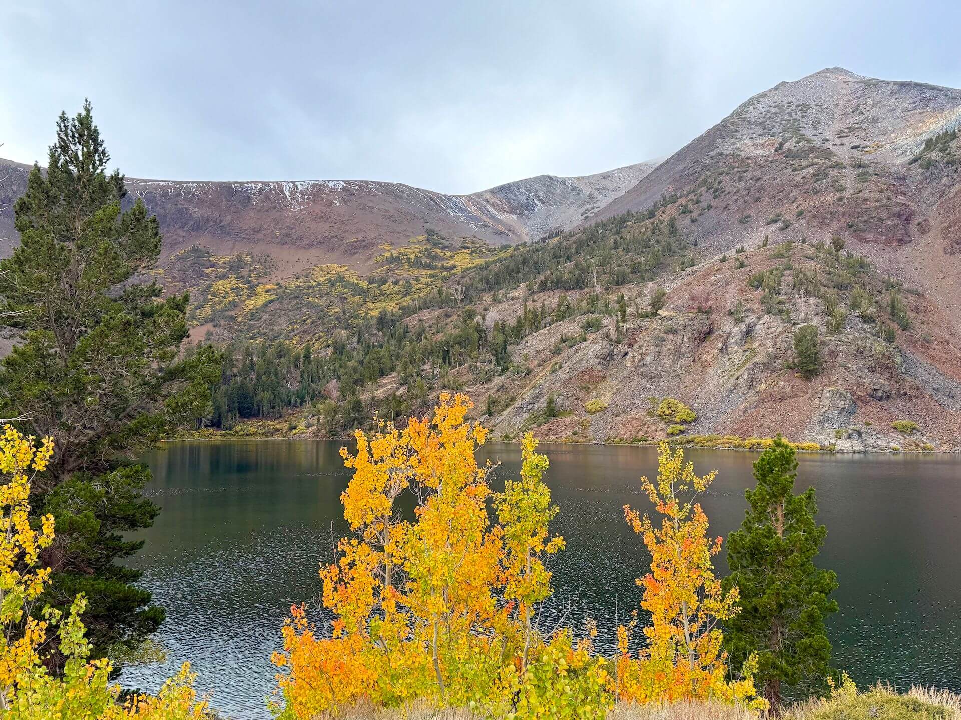
Virginia Lakes (9,819’) — 50-75% Near Peak (Go Now.) Virginia Lakes is glowing in shades of gold, with some groves already beginning to shed their leaves. Along the creek in the lower areas, the landscape is a vibrant mix of mostly yellow and gold, with a few hints of orange — and very little green remaining. A small, fresh dusting of snow on the mountain above the lake adds to the magic of the scene. It was about 45°F here this afternoon, and cooler temperatures could accelerate changes in the days ahead.
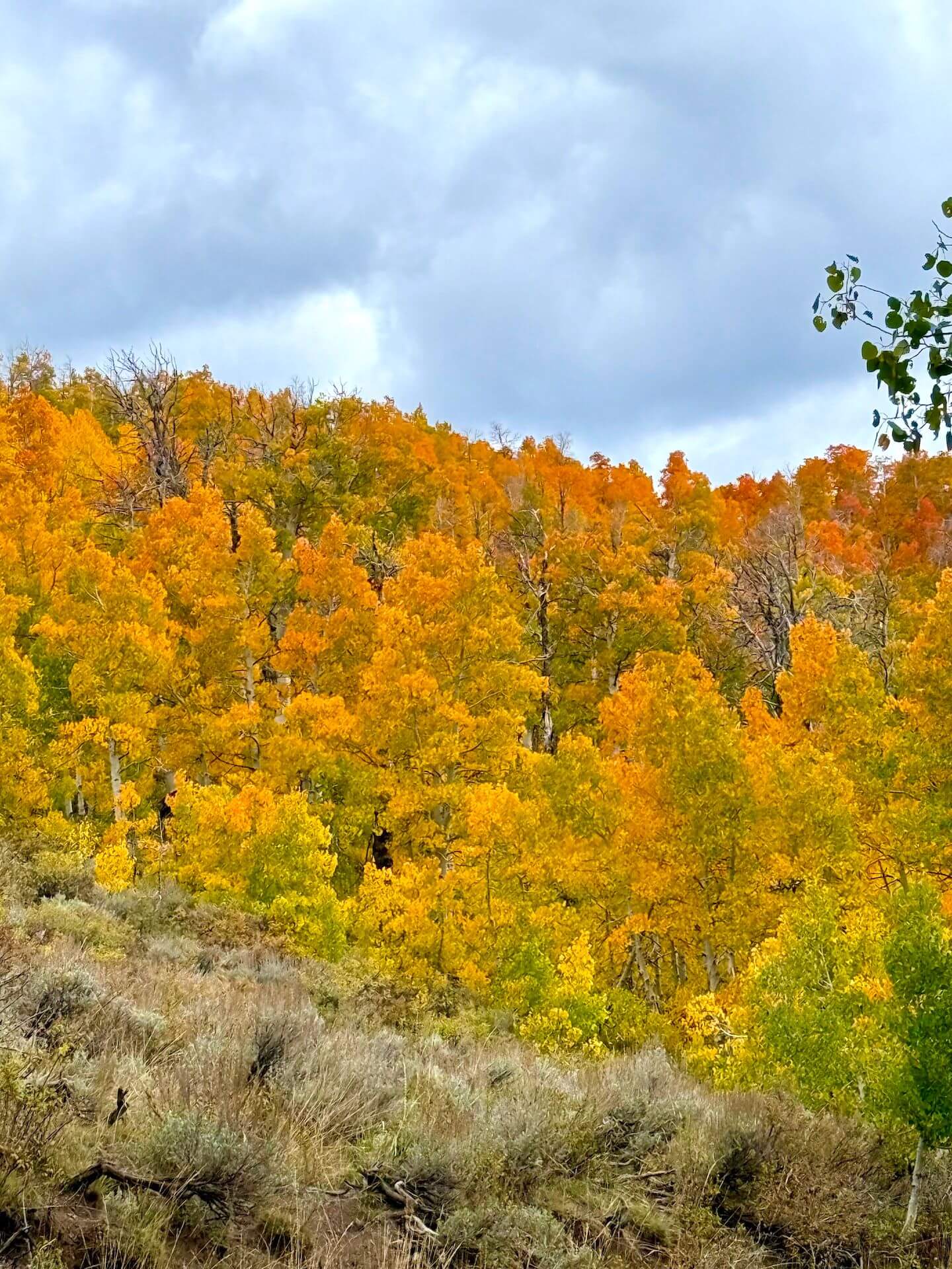
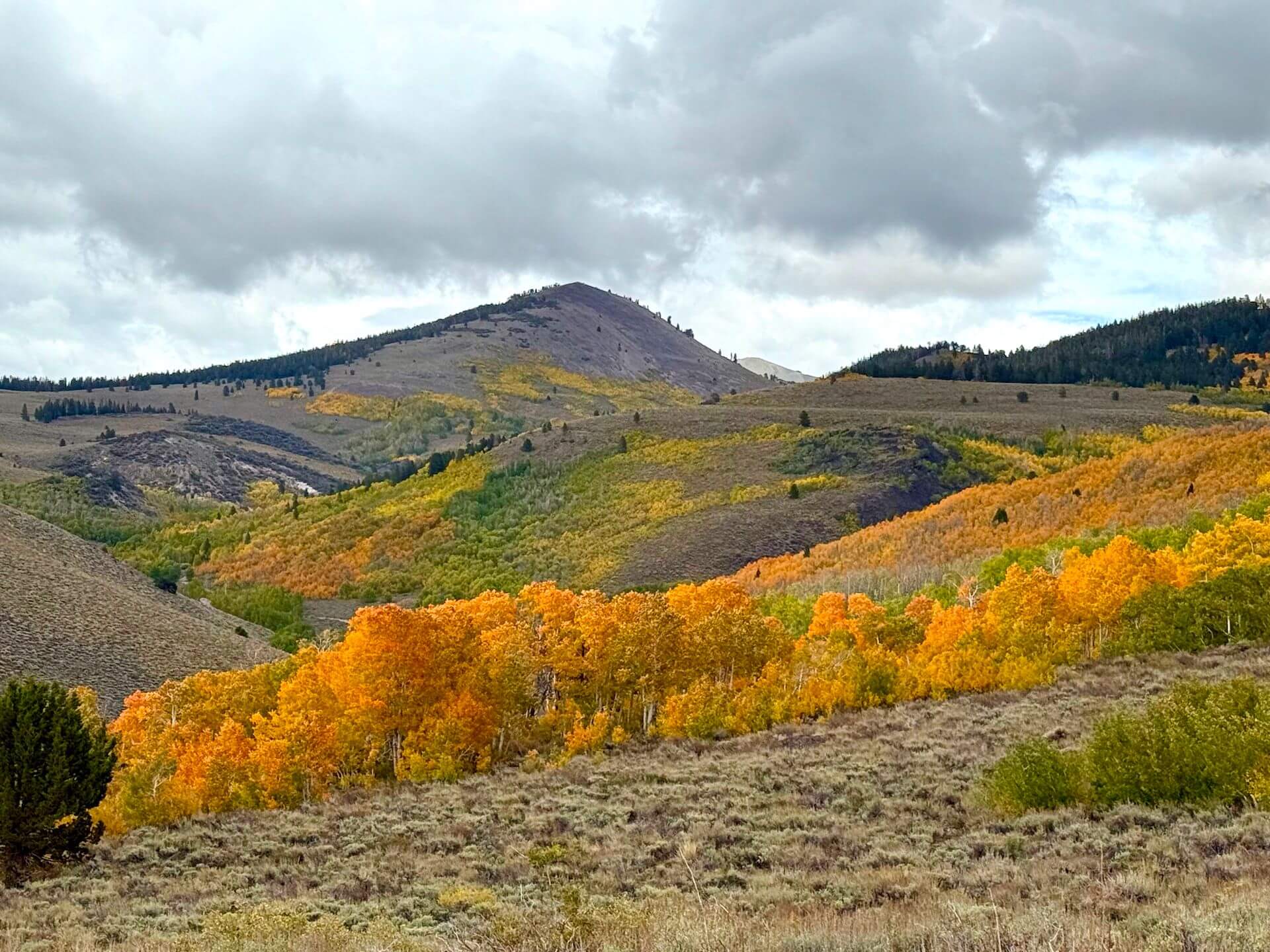
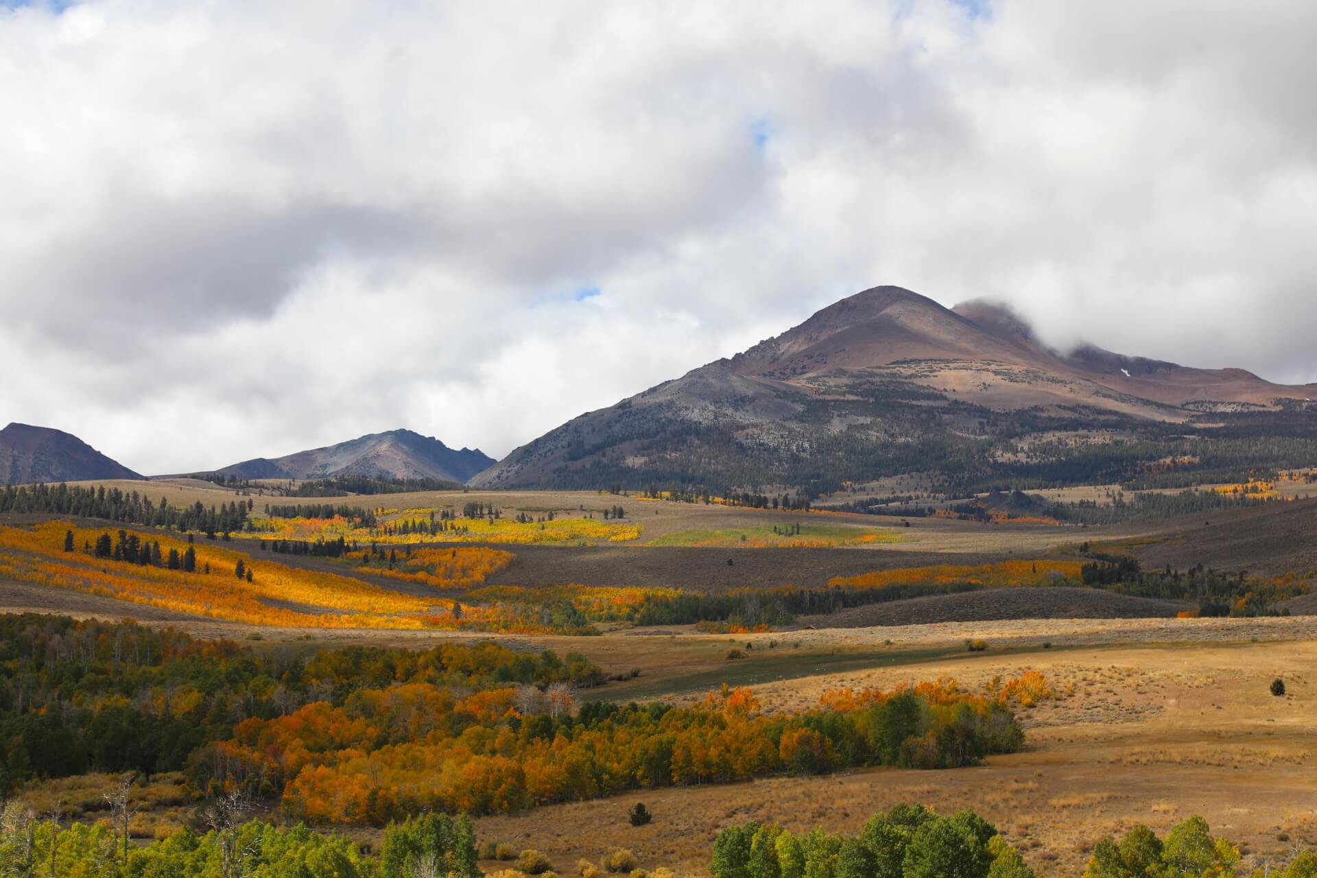
Conway Summit/Dunderberg Meadows (~8,143) — 50-75% Near Peak (Go Now.) This scenic area is moving quickly toward peak color. Dundergberg Meadows Road, just off Virginia Lakes Road, is already in the 75–100% range, with brilliant orange and red pockets lighting up the hillsides. The surrounding slopes are closer to 40–50%, but change is progressing rapidly and should accelerate with cooler weather. This is a classic Eastern Sierra fall color location and well worth a visit now — with even more beauty to come in the days ahead.
Summers Meadow/Green Creek (7,200’+) — 10-50% Patchy. This stunning area is coming along beautifully, with upper elevations showing vibrant reds and oranges, the middle slopes shifting into golden yellow, and lower sections near the road still mostly green. Change is progressing quickly here, and the upper meadow could be near peak as soon as next week. This lesser-known gem is absolutely worth a visit as fall color continues to unfold.
Tip: This fall color adventure area would be perfectly paired with a visit to Bodie State Park.


LEE VINING
Tioga Pass (9,943′) — 75-100% Peaking (GO NOW!) Aspens at the 9,000’ elevation mark are currently at peak, joined by vibrant willow bushes around Ellery Lake. Higher up, near 10,000’ at the pass, the willows have already moved past peak. For dramatic fall color views, this drive is a must for your weekend itinerary (and despite the shutdown, Yosemite National Park remains open).
Lee Vining Canyon (6,781′) — 0-10% Just Starting. Not much change has happened here yet, as this is typically one of the later locations to turn. A few scattered trees are starting to show color, standing out against the backdrop of mostly green.
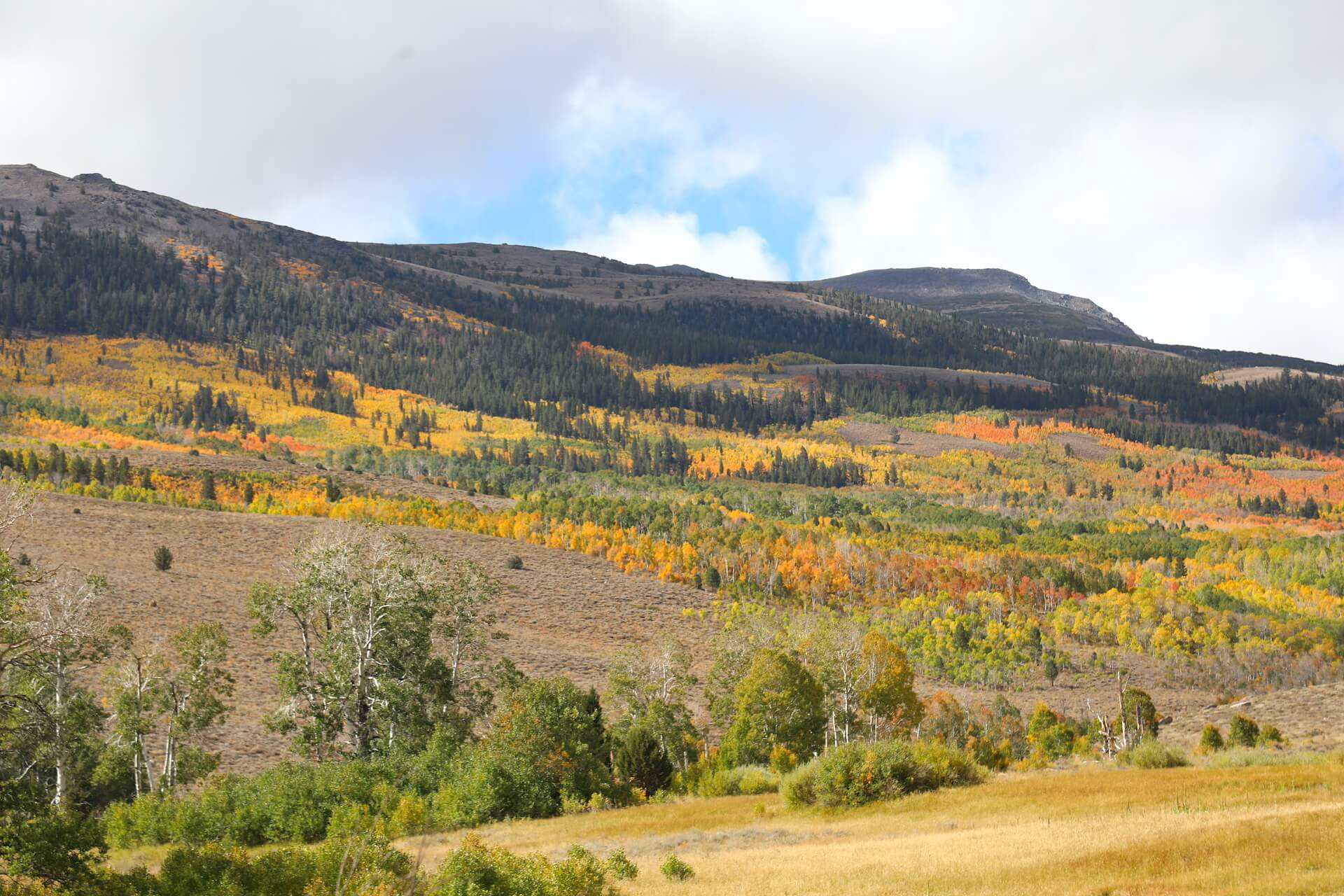
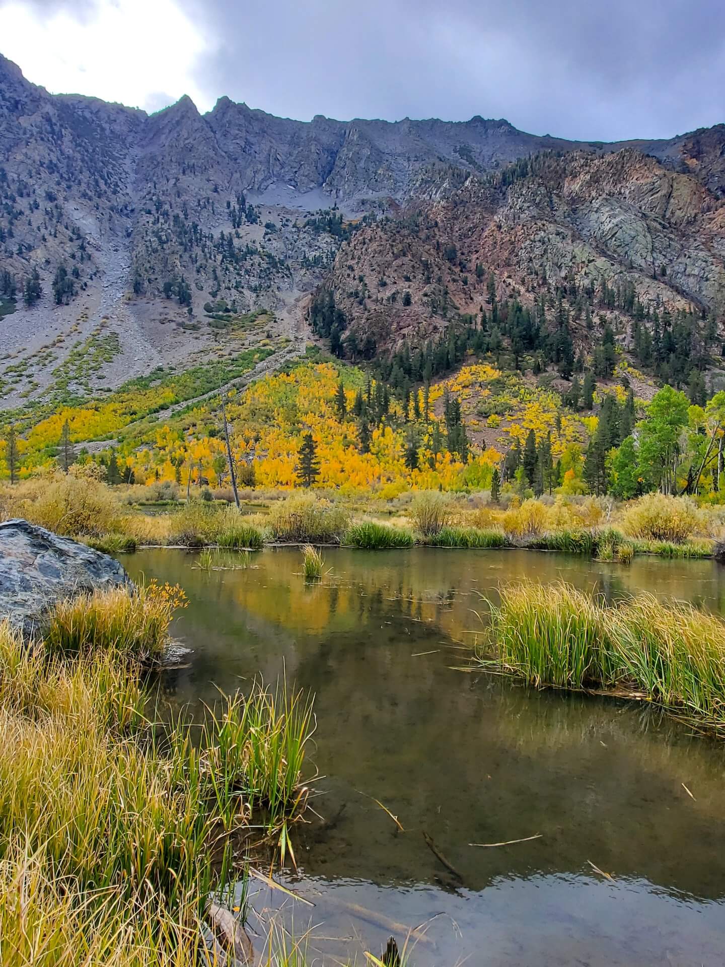
Lundy Lake & Canyon (7,858′) — 50-75% Near Peak (Go Now.) Lundy is looking beautiful (as always), with some lower areas still holding green while much of the canyon has just crossed into the 50–75% range. Getting to the lake and resort is perfect for most visitors. Beyond the resort, the road becomes dirt/gravel and narrows. There’s a lot of color, beaver ponds, and a fantastic hiking trail, but go early and be prepared to turn around if you can’t find a designated parking spot. This area can get busy, the road is windy, and there are few turnouts. Please drive slowly, park safely, and enjoy the vibrant fall scenery responsibly.
BENTON & 120 EAST
Sagehen Summit (8,139’) — 75-100% Peaking (GO NOW!)
Sagehen Summit is peaking and remains a “Go Now” destination. Color held strong through the weekend, with plenty of vibrant displays still visible in social media posts. Upcoming storms may push some areas past peak, though. We’ll share what we see from others but will not be visiting this location again this season.
Please Note: This is a remote dirt road with no cell service or facilities. Stop at a visitor center visitor center in Lee Vining before heading out, and bring plenty of gas and water. Wildlife is abundant here, so drive slowly, pack out all trash, and use designated parking or pullouts (never stop in the road). Enjoy the colors on foot, and watch for cars and OHV riders.
Federal Lands update during shutdown
According to our friends at Mono County Tourism, about 94% on Mono County is public land, including two incredible national forests – Inyo and Humboldt-Toiyabe – plus extensive Bureau of Land Management lands. We’re also the eastern gateway to Yosemite National Park.
While some services may be limited during a federal government shutdown, federal lands remain open for recreation. Trails, lakes, roads, and many outdoor spaces are still accessible – but it’s more important than ever to be safe, self-sufficient, and excellent stewards of the land. Pack out all trash (all the way out, which may mean all the way home), follow fire safety precautions, respect wildlife, and tread lightly to help protect these beautiful places now and always.


Appreciate the summary and update!